For CapeNature and Theewaterskloof Municipality to review
This page has not yet been checked by the bodies it names. Questions for them:
- For CapeNature: in whose name is Farm 38 registered, and since when has CapeNature managed it?
- For Theewaterskloof Municipality: is any part of Farm 38 part of Greyton’s mountain commonage?
- Does the Greyton Nature Reserve, or its proposed extension, include this farm?
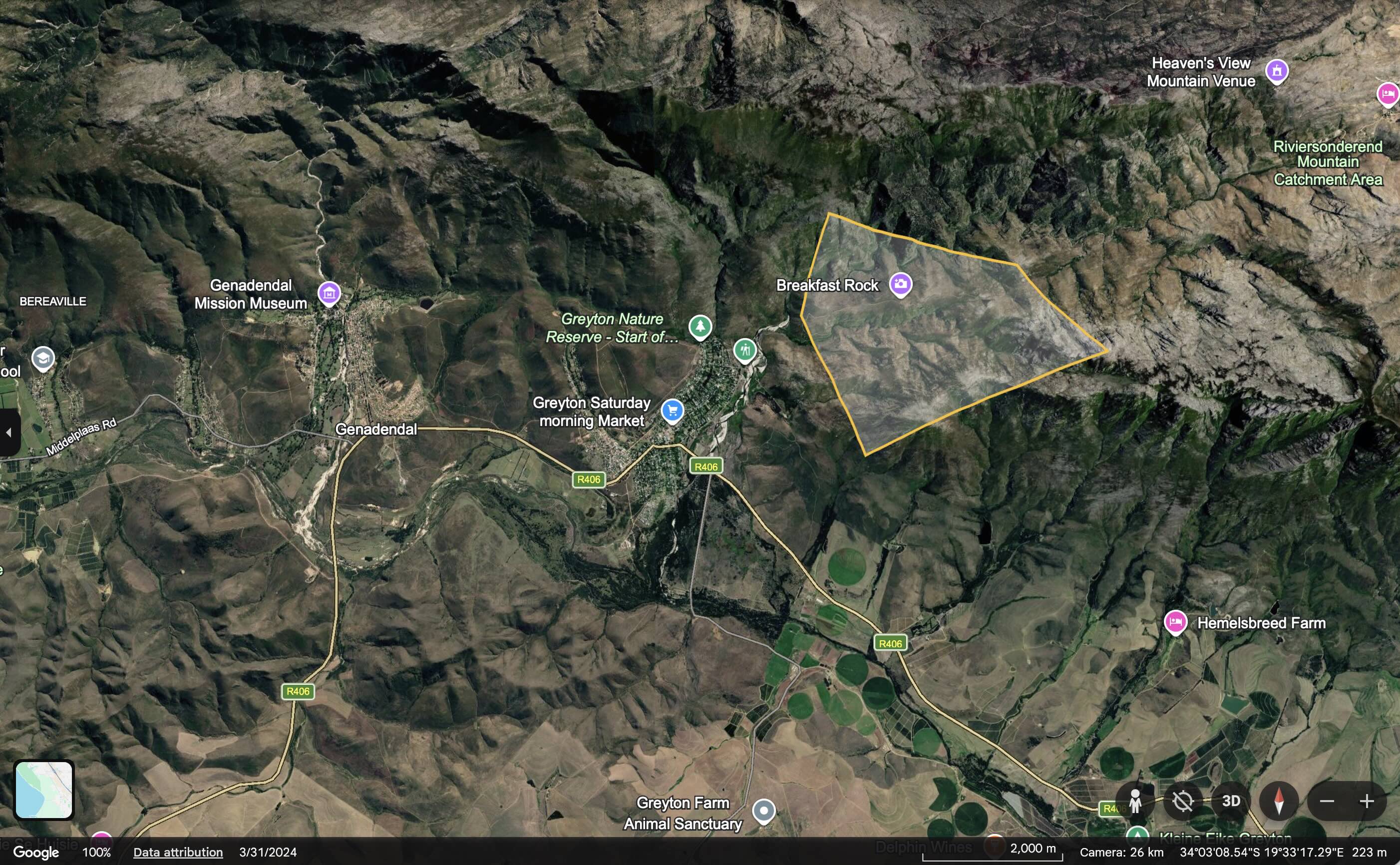
Farm 38, Boschmans Kloof, is one of the mountain farms above Greyton in the Caledon registration division [IC]. It lies in the mountains north-east of Greyton, in the upper kloof of the Gobos River [MS]. The DevForum’s land table lists Farms 32 to 38 together as CapeNature land [MS]. Little else about its history has been recorded yet, and this page sets out what is known and what is still open.
Map: see this property on the DevForum’s Google Earth map of the valley’s land, which shows the Surveyor-General boundaries of all eight properties.
What the letters in square brackets mean
Facts on this page are followed by a tag that shows where they come from.
- [IC] Independently Corroborated. Confirmed by at least two sources that do not depend on each other, or by an official record such as a Surveyor-General record or a law.
- [MS] Mission-Sourced. Comes from one party’s own documents or statements, or from the DevForum’s own research and maps. It has not been checked against other sources.
- [TBV] To Be Verified. Seems likely, but nobody has confirmed it yet.
At a glance
| Name in the Surveyor-General’s records | BOSCHMANS KLOOF [IC] |
| Farm number | 38, Caledon registration division [IC] |
| Surveyor-General code | C01300000000003800000 [IC] |
| Area | 740.92 hectares on the DevForum’s map, from the Surveyor-General’s records [IC] |
| Municipality | Theewaterskloof, Overberg District [IC] |
| Held by | CapeNature, according to the DevForum’s land table [MS] |
The name
The farm shares its name with the kloof, and with the settlement of Boschmanskloof on the edge of Greyton. They are different places: the settlement is part of Genadendal in the municipality’s spatial plan [IC] and stands on Farm 39 land [MS], while Farm 38 is mountain land.
History
- Before Greyton. Greyton sources say the Hessequa leader Stoffel Koekson moved his people to Boschmanskloof in the late 1600s [TBV], and that Herbert Vigne first settled on a farm at Boschmanskloof before he bought Weltevreden in 1846 [TBV]. Whether either account refers to Farm 38, or to land lower down where the settlement stands, has not been established.
- The trail. CapeNature publishes the Boesmanskloof hiking trail between McGregor and Greyton [IC]. The trail crosses Farm 38, and Breakfast Rock is in Farm 38.
- The mountain commonage. Greyton’s histories say Herbert Vigne left the land around the village to its plot owners as a commonage [TBV]. On 13 May 1977 the Greyton Nature Reserve, about 2,200 hectares, was proclaimed on the “mountain commonage”, up to the peaks of Uitkyk, Wa en Osse and Perdekop [IC].
- Who manages the mountain. The register’s sources do not agree. One records that the Greyton Conservation Society helps Theewaterskloof Municipality manage the reserve [MS]. The DevForum’s land table lists Farms 32 to 38 as CapeNature land, with the reserve covering about 2,200 hectares of them [MS]. Whether Farm 38 is part of the reserve, the commonage, or other CapeNature land has not been confirmed [TBV].
- The 2019 fire. A fire burned about 5,950 hectares on the mountain slopes above Greyton in December 2019 [IC]. Whether it reached Farm 38 has not been checked.
- Extension. The Greyton Conservation Society says CapeNature’s stewardship panel has approved a proposed extension of the reserve [MS].
On the DevForum’s map
- The farm lies in the mountains north-east of Greyton, in the upper kloof of the Gobos River [MS].
- Two of the three dam-wall options drawn on the Gobos in the DevForum’s map (G1 and G2) fall inside Farm 38 [MS]. These are options for the idea on Community-Built Dams on the Baviaans and Gobos, which the DevForum has not agreed.
- The upper Gobos feeds Greyton’s leiwater, which has carried water to the village’s plots since 1854 [MS]. See Greyton’s Leiwater.
What is still open
- Who holds title to Farm 38, and since when.
- Whether it was ever part of Greyton’s commonage, or of the farm Weltevreden.
- Whether it lies inside the Greyton Nature Reserve or the Riviersonderend Complex.
- What the date on the Surveyor-General record (2018-05-29) marks.
Have your say
If you hold records of this farm, or know its history, contact the moderators via How to Submit.
Related
- Farm 32: Langgezocht
- Erf 595, Greyton
- History of Greyton
- CapeNature
- Greyton Conservation Society
- Why Alien Clearing?
- All villages
References
- Chief Surveyor-General. Cadastral record for Farm 38, Caledon, shown on the DevForum’s Google Earth map of the valley’s land. The name, number, code and area.
- History of Greyton and Brian Rycroft, and the sources listed there. The commonage and the 1977 reserve.
- CapeNature and the sources listed there. The reserve extension and the Boesmanskloof trail.
- Why Alien Clearing? The DevForum’s land table.